Marshfield's Most Expensive Village Isn't on the Ocean
September 24, 2026
September 24, 2026
Ask anyone shopping the South Shore where the priciest real estate in Marshfield sits, and they will point toward the water. Brant Rock. Ocean Bluff. Rexhame. The villages with sand in the name and the Atlantic at the end of the street.
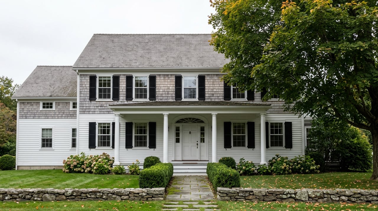
They would be wrong, at least by the numbers. The village posting the highest median sale price in Marshfield right now sits a few miles inland, along a tidal river, in a cluster of antique Capes and colonials that most out-of-towners have never heard of: Marshfield Hills.
Here is how the four numbers actually line up.
| Area | Recent Median Sale Price | Year-Over-Year Change | Typical Days on Market |
|---|---|---|---|
| Marshfield Hills | $1.1 million (Dec. 2025) | up 14.6% | about 19 days |
| Marshfield Center | $890,000 (3 months ending May 2026) | up 11.2% | about 19 days |
| Ocean Bluff-Brant Rock | $725,000 (Aug. 2026) | up roughly 11% | about 16 days |
| Marshfield, townwide | $770,000 (Nov. 2025) | down 1.3% | about 20 days |
Notice where the townwide figure lands. It sits almost exactly between the ocean village and the historic river village, which is a clue that the citywide median is quietly averaging two markets moving in opposite directions. A buyer who only reads the townwide number and concludes Marshfield is cooling would miss that its two most distinct villages are both posting double-digit annual gains. The softness is happening somewhere in the middle, not at either end.
The logic behind "waterfront costs more" isn't wrong as a general rule. It's wrong as a rule for comparing Marshfield's coastal villages against its river villages, because those two kinds of water access come with different regulatory price tags attached.
Ocean Bluff-Brant Rock sits along five miles of Atlantic shoreline, and a meaningful share of its housing stock, including new construction, gets built on pilings specifically because of flood zone requirements. That's not incidental detail. It shows up in how homes there get marketed: listings in this village routinely call out whether a property sits inside or outside a flood zone as a selling point, sometimes as the first line of the description. A house on the same street, at a similar price, can carry a materially different insurance and construction cost load depending on which side of a flood zone boundary it happens to sit on.
Massachusetts flood insurance typically runs $500 to $1,100 a year, with most homes landing between $700 and $900. That average hides the range that matters here. A coastal home in a high-risk AE or VE zone can cost well above that band, while an inland Zone X home can land below it, and elevation, foundation type, and deductible all move the number further.
Getting a defensible answer on where a specific address falls usually means an elevation certificate, which documents a building's height relative to the base flood elevation set for its location. The Federal Emergency Management Agency requires this documentation to confirm compliance with local floodplain rules, and lenders and insurers use it to set premiums. Nationally, an elevation certificate averages around $600, with a realistic range from $170 to $2,000 or more depending on property type and local demand for surveyors. A favorable certificate can save a homeowner meaningfully on the annual premium. An unfavorable one confirms what the flood map already suggested and locks in the higher cost.
None of this is theoretical for Ocean Bluff-Brant Rock buyers. It shows up in the listings themselves, where "not in a flood zone" and "raised foundation" appear as marketed features, and where new waterfront construction sits on stilts as a matter of course rather than architectural preference.
A house a quarter mile from the ocean and a house a quarter mile from the North River can carry entirely different insurance bills, even at an identical price per square foot.
Marshfield Hills sits along the North River, a federally recognized National Natural Landmark that separates Marshfield from Scituate, and that river geography gives the village water access without the same wave and storm-surge exposure that puts much of Ocean Bluff-Brant Rock into stricter flood categories. Buyers there get docks, kayak launches, and river views while sidestepping the construction and insurance math that comes with building directly on an oceanfront dune. Even the village's most water-exposed listings lean on this distinction. One recent estate offering overlooked both the North River and the ocean beyond it, and the listing specifically noted the home sat outside the flood plain, a detail that reads less like a footnote and more like the actual selling point.
The village carries other advantages that compound the price gap. Its center is a preserved 18th and 19th century historic district, anchored by the Marshfield Hills General Store, a gathering spot that has operated since 1853 and is now owned by actor Steve Carell and run by his family. The North River Arts Society hosts an annual festival each May that draws visitors from across the South Shore, and the Daniel Webster Wildlife Sanctuary sits nearby with trails through conservation land. Lots here tend to run larger, some approaching an acre or more, a contrast to the smaller in-town parcels common along the beach blocks closer to the ocean. And commuting works differently too. Some Marshfield Hills addresses sit roughly three miles from the Greenbush commuter rail station in neighboring Scituate, while homes in the coastal villages typically run closer to ten miles from that same station.
If you're weighing a Marshfield purchase against price per square foot alone, the villages will mislead you. The more useful question isn't how many miles a house sits from salt water. It's which flood zone letter applies to that specific parcel, because two homes an identical distance from the coastline can carry very different cost structures once insurance and any required construction standards are factored in.
A few habits make that comparison honest:
Does every home in Ocean Bluff-Brant Rock require flood insurance? No. Flood zone status varies parcel by parcel even within this village, which is exactly why so many listings there specify whether a given house sits inside or outside a flood zone. Distance from the beach is not a reliable stand-in for zone designation.
Is Marshfield Hills completely free of flood risk? No village on Marshfield's rivers is risk-free, and some North River addresses do carry flood zone ratings. The point isn't that the village is immune. It's that the flood zone line, not the postcard water view, is what actually drives cost, and that line runs differently through Marshfield Hills than it does through the oceanfront villages.
How do I find out a specific address's flood zone before I make an offer? Your agent can pull FEMA flood maps for any address and, where one exists, request the property's elevation certificate as part of due diligence. Doing this before you fall in love with a house saves a renegotiation later.
Comparing villages by median price alone will tell you where Marshfield's market has been. Comparing them by flood zone will tell you what a specific house will actually cost to insure and to own. If you're weighing an oceanfront cottage in Brant Rock against a river-corridor antique in Marshfield Hills, that's the conversation worth having before you write an offer. Kornerstone Real Estate Brokerage works through exactly this kind of village-by-village detail with buyers across the South Shore, and a Koncierge consultation is a good place to start sorting out what a given address will really cost to own, not just to buy.
Stay up to date on the latest trends in real estate.
October 1, 2026
September 24, 2026
September 17, 2026
September 10, 2026
September 3, 2026
September 3, 2026
August 27, 2026
August 20, 2026
August 13, 2026
Let us learn more about how I can help. My goal is to be your Real Estate Consultant for Life!